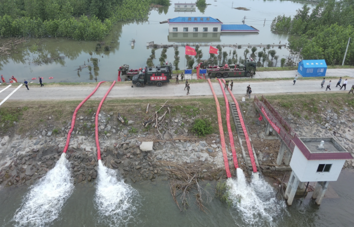
BEIJING, July 14 – Chinese emergency authorities deployed an array of satellites, including Fengyun meteorological satellites, to support rescue efforts after the recent dike breach at central China’s Dongting Lake.
A burst dike in Tuanzhou Township, Huarong County under Hunan Province’s Yueyang City triggered flooding in the area on July 5. Thousands of rescuers, including firefighters, hydrologists, volunteers and police, worked tirelessly to safeguard lives and properties.
Fengyun satellites provided real-time monitoring of precipitation in the affected area and upstream regions, offering crucial information to support emergency rescue efforts, said the satellite’s developer on Saturday.
Beyond real-time monitoring data, Fengyun satellites provided a wealth of additional information. This included cloud maps, cloud height and temperature products, cloud phase data, precipitation estimates and detection products. This comprehensive data set significantly bolstered meteorological forecasting services in the disaster zone.
In addition, several other satellites, including Gaofen-3 02, Gaofen-3 03, Gaofen-1, and Gaofen-4, were deployed to provide real-time observation of the affected areas as well, according to the China Center For Resources Satellite Data and Application (CRESDA).
The relief efforts were further bolstered by commercial satellite companies. Chang Guang Satellite Technology Co., Ltd. deployed its Jilin-1 Kuanfu 01A satellite, capturing high-resolution images shortly after the dike breach.
Other commercial players also joined the mission. Smart Satellite Technology Co., Ltd. utilized its SmartSat-X1 satellite to gather detailed data on the disaster zone. Additionally, Beijing Minospace Technology Co., Ltd. activated its Taijing-4 01 and Taijing-4 03 satellites to contribute to the relief efforts.
The breach in Dongting Lake’s embankment at Tuanzhouwan was sealed by 10:30 p.m. on July 8.


